Nepean Boulevard
Image Source: TCL
Nepean Boulevard
Image Source: TCL
Nepean Boulevard
Image Source: TCL

Nepean Boulevard
Image Source: TCL
Nepean Boulevard
Image Source: TCL
Nepean Boulevard
Image Source: TCL
Nepean Boulevard
Image Source: TCL
The project
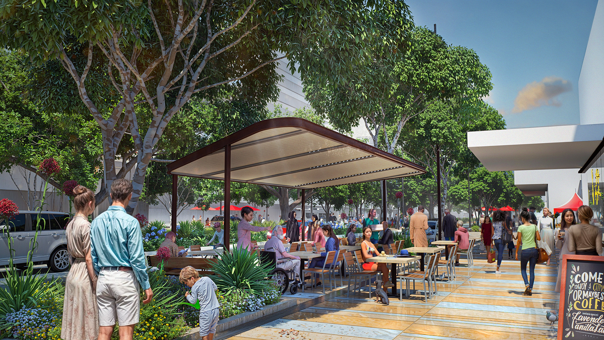
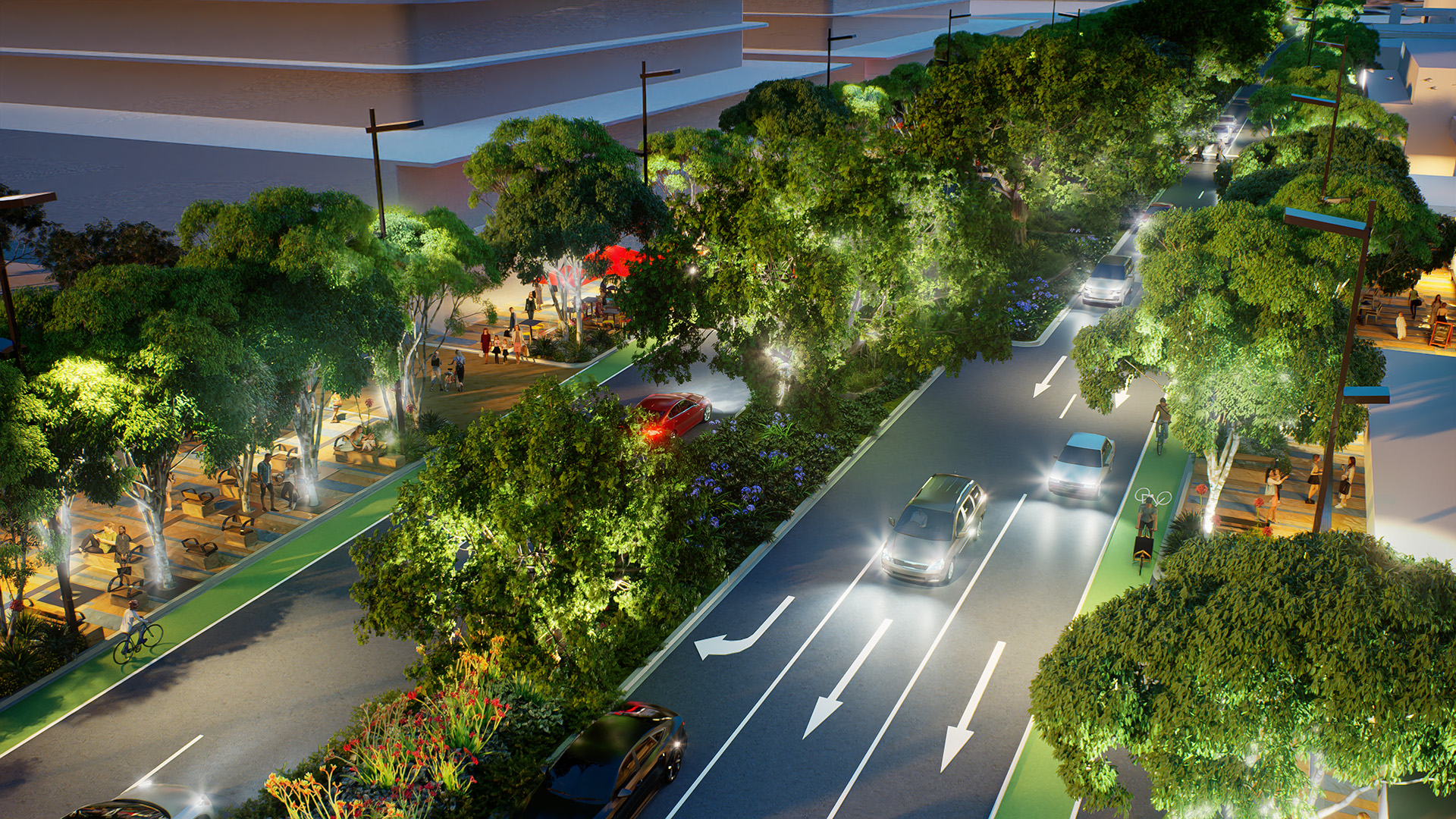
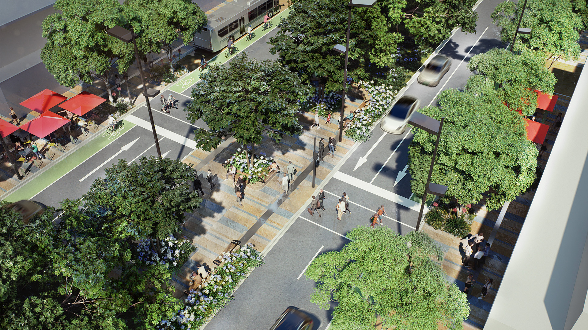
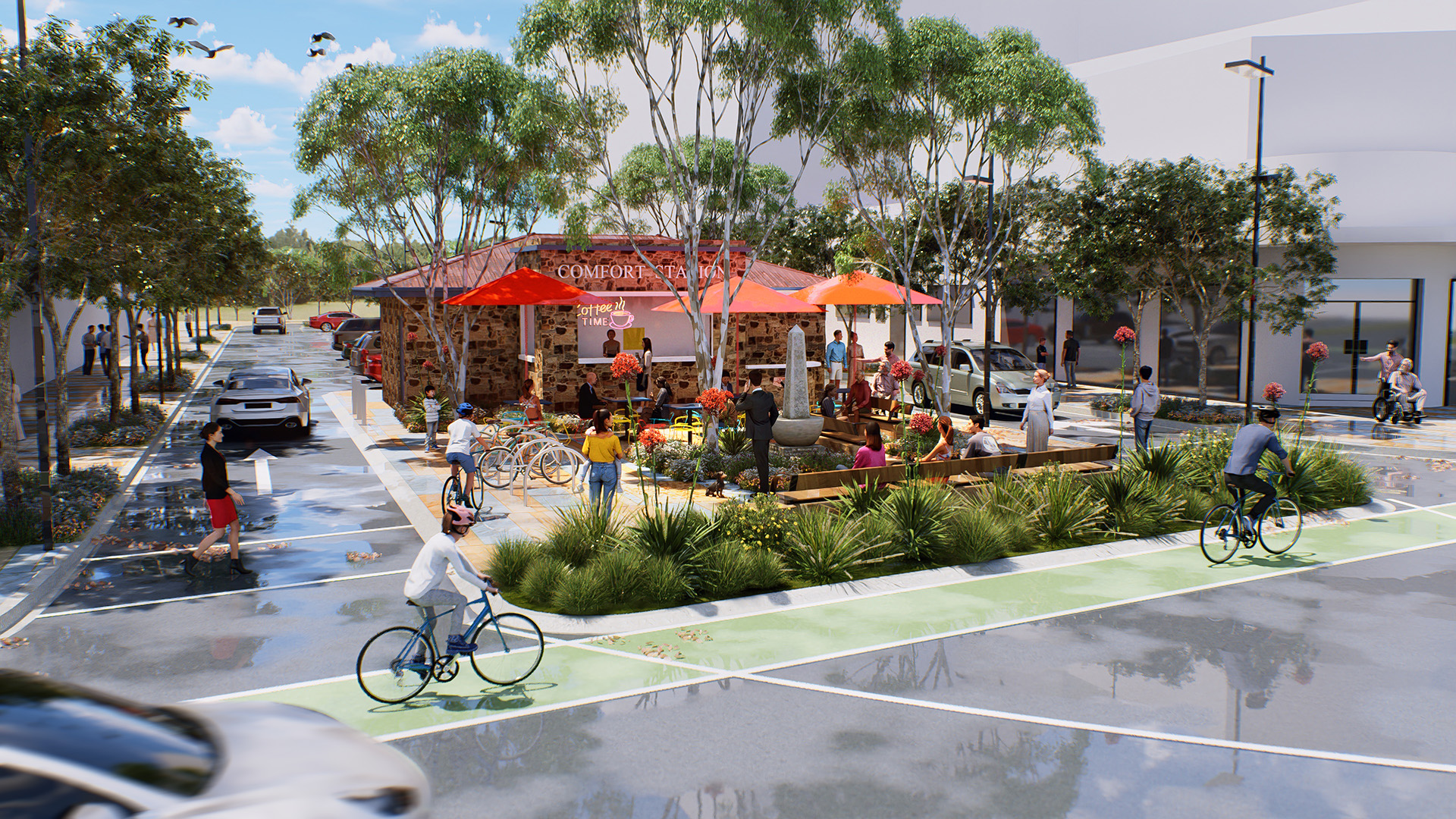
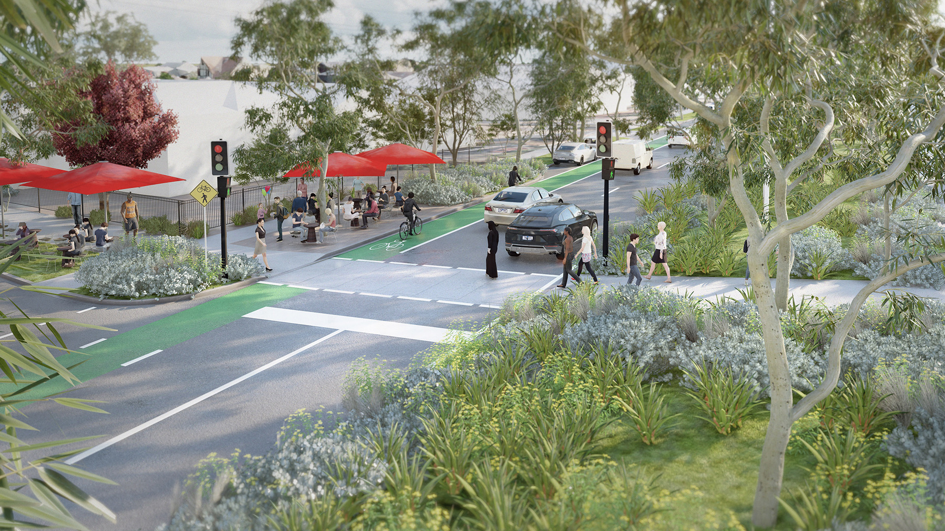
The 3.7km stretch of the Nepean Highway, currently comprised of 3 lanes in each direction through the Frankston CBD, will transform from a car-focused corridor into a more balanced, people-oriented urban space where residents and visitors can live, work and play.
The arterial road is proposed to be reduced to 2 lanes in each direction through central Frankston, with dedicated cycle lanes connecting to the existing network, widened pavements to support outdoor hospitality, and additional tree planting.
While the Nepean Boulevard will be redefined as a vibrant pedestrian-focused destination, offering alternative transport options including walking, cycling, and public transport, it will also maintain its current critical role as a major transport corridor servicing significant vehicular and bus traffic. The broader Frankston Metropolitan Activity Centre transport network will play a key role in managing the distribution of traffic and uplift across the region.
Our Work
Our transport team was engaged by award winning landscape architecture practice, TCL, to provide preliminary traffic modelling, engineering design advice and complete a Movement and Place Assessment to help inform Frankston City Council’s Nepean Boulevard Masterplan project.
We conducted a detailed Movement and Place assessment for key roads within the Frankston Metropolitan Activity Centre to evaluate the Nepean Highway’s aspirational classification against its existing performance and understand how the proposed masterplan initiatives align with the project vision.
The project adopted a ‘vision and validate’ approach, rather than a ‘predict and provide’ model, to address the fundamental challenge of balancing vehicular movement across the network while supporting and enhancing placemaking objectives and other sustainable transport modes.
A key outcome of the assessment was the identification of opportunities to enhance the performance of other transport modes, such as walking, cycling, and public transport, while still meeting the target performance score for vehicle traffic and freight. This finding aligned strongly with the Nepean Boulevard masterplan objectives and Frankston Metropolitan Activity Centre Structure Plan.
As part of the project, we facilitated workshops with the Department of Transport to explain changes to Movement and Place classifications and objectives, and their implications for the broader road network.
This assessment, completed by Ratio’s in-house team of specialist Movement and Place practitioners, allowed Frankston City Council to move forward with a vital piece of strategic work that will help shape the future of transport and public realm in Frankston.
Use ⌘/Windows key + scroll to zoom